Generate Your Own Filipino Christmas Parol-Inspired Digital Greeting Cards using Geospatial Data!
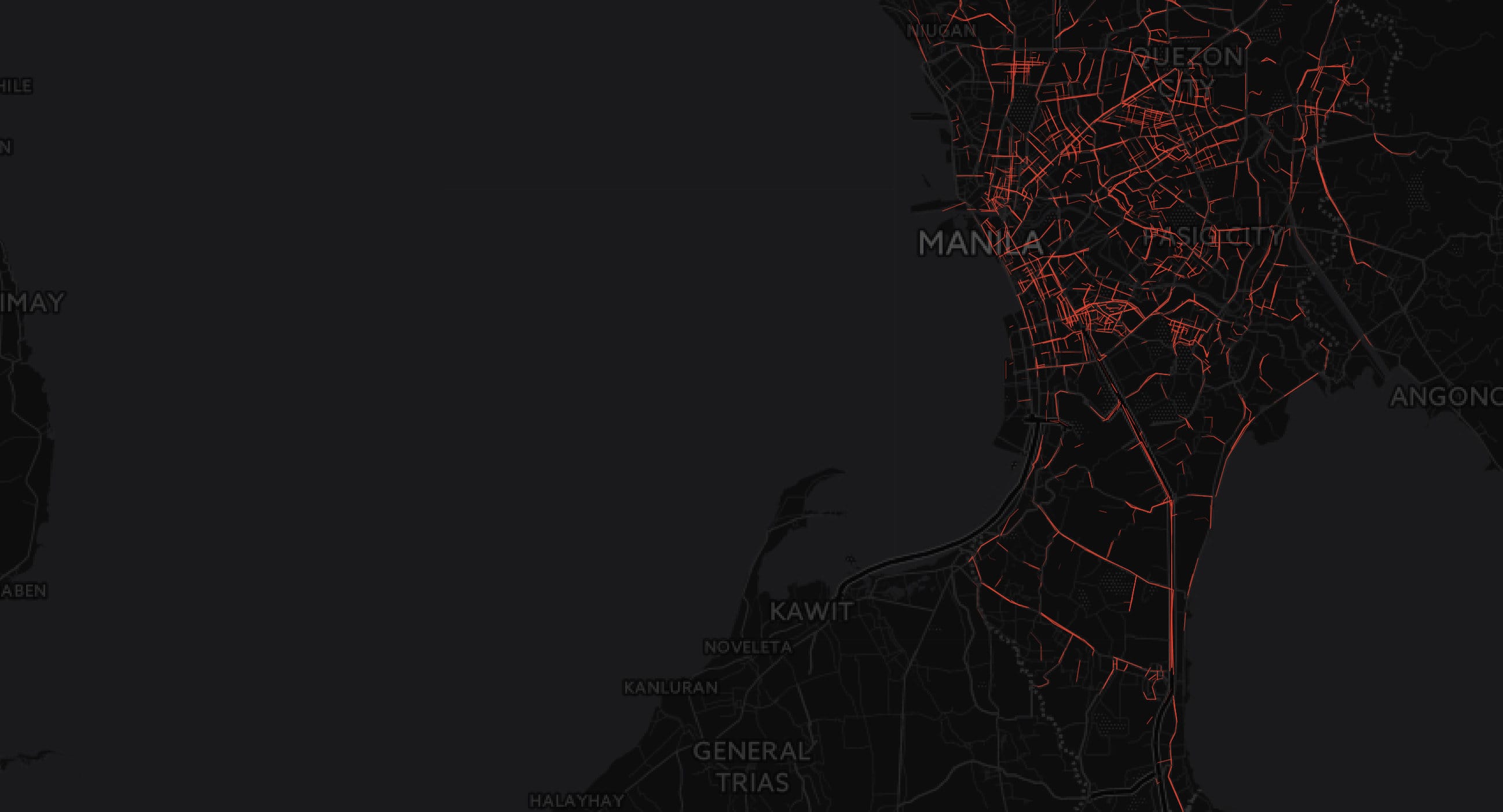
It’s the holidays again! Traditionally, this means that we at Thinking Machines take something as ordinary as a Christmas greeting card and give it an algorithmic spin. From creating a snowflake generator to training an artificial intelligence system to generate unique pieces of artwork in the style of famous artists, we are now back with another Christmas card generator. This time, we were inspired by the most Filipino of Christmas traditions, the Christmas parol, as most of our team is based in Manila. We used a map, Waze traffic data, and Mapbox Isochrones to create a Christmas inspired street map pattern that resembles a typical Filipino Christmas parol.
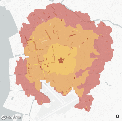
You can now generate your very own Christmas isochrone street map card: you just have to drop the pin anywhere on the map - it could be your home, your friend’s office, where you met your significant other - and a shape will be generated around it. The shape is called an isochrone, a shape around a particular point on a map that represents the reachable area within a set amount of time. In this case, the isochrone generated represents the reachable area within 5, 15, and 30 minutes by walking.
To spice things up and make it look more festive, we added a layer of Waze traffic data to make the roads light up in various colors depending on the congestion level. The end result is a nerdy version of a Filipino Christmas parol, with the isochrone being the parol and the traffic data being the Christmas lights.
Try it out below and share it with your family and friends! Happy Holidays from our team here at Thinking Machines.